Back to Projects

Team Name:

Data Down Under


Team Members:


Evidence of Work

Data Down Under

Project Info

Data Down Under thumbnail

Team Name


Data Down Under


Team Members


Aniket Raj , Steven , Simon Bunker , Tom

Project Description


A strategic data centre development solution that layers GIS data to answer relevant questions in data centre location selection.

The Data Down Under Application
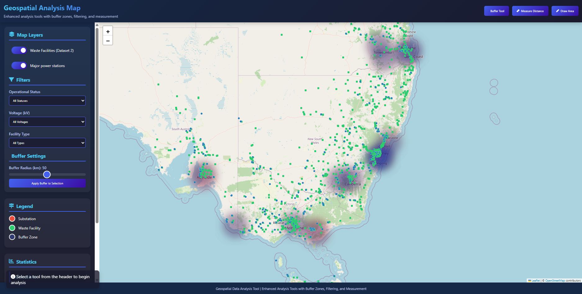
Screenshot of the Data Down Under Application

A closeup of Sydney in the Data Down Under Application
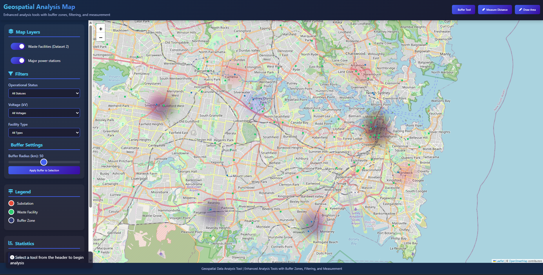
Screenshot of the Data Down Under Application - closeup of Sydney

It aims to answer 5 specific key categories in mapping for Development Suitability, Land cost, environmental risks, Latency analysis and access to resources.

Each of these categories are made up of relevant datasets that aggregate to a scoring system that help shareholders determine a location that best meets their needs.

Visualizing data sets using Kepler
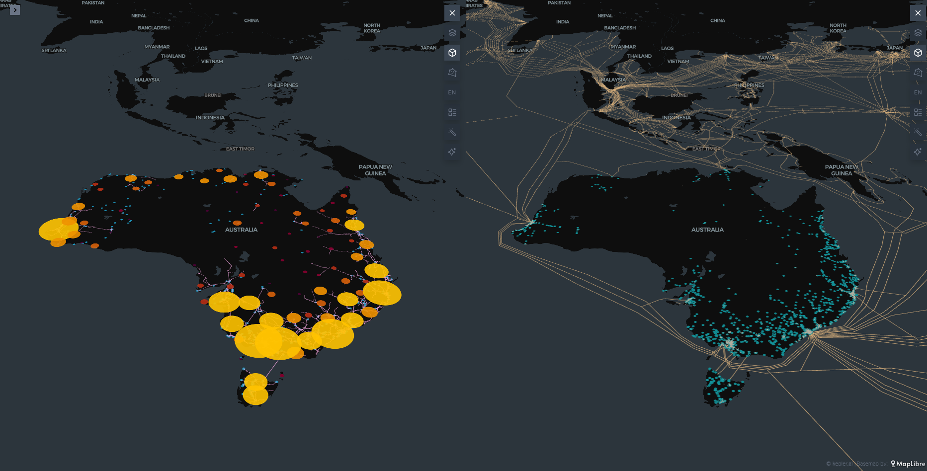
Data sets visualized in Kepler

Australia Land use data

Australia Land Tenure data

Australian Water observations - indicating flood risk
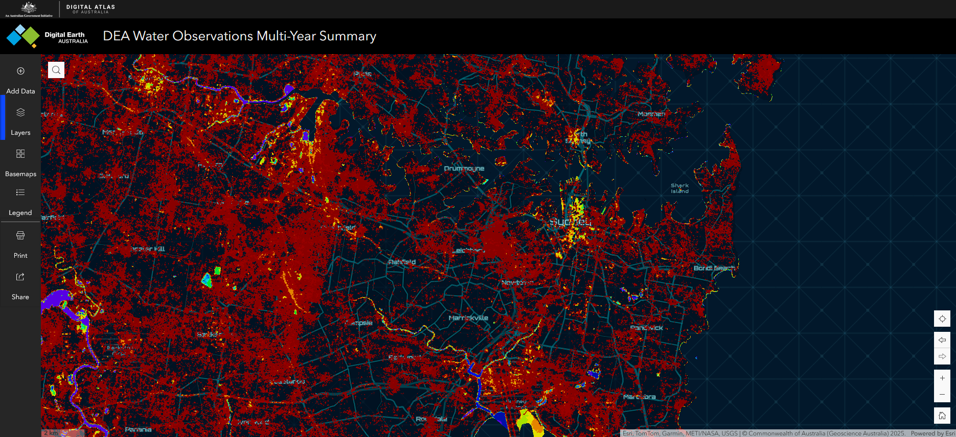
Australian Water observations indicating flood risk

Data Centre Down Under has chosen these categories to answer questions of an optimal data centre location from multiple perspectives. Vested interests have different priorities when it comes to filtering out these locations. These perspectives include the Australian government, data centre investors and energy providers.


#datacentre #ai #energy #telecommunications #visualization #risk #planning #infrastructure

Data Story


Our Solution aims to provide data to answer questions in data centre development for a range of stakeholders- government, data centre investors and energy providers. It does this by layering relevant GIS data to visualise an aggregate map that shows optimal locations for site selection. The solution analysis data upon 5 key categories: Development Suitability, Land Cost, Risk Assessment, latency analysis and resource access. Development Suitability compares greenfield and brownfield sites based on total cost of ownership (land cost, energy connection cost and construction costs). Risk Assessment layers GIS data for affected areas of natural disasters (flood maps, bushfire maps). Latency analysis maps which shows proximity to population centres combined with ISP telecommunication infrastructure data to find ideal data centre sites that result in low latency performance.

Additional Evidence of Work

Note that we have additional Evidence of Work dataset cleanup scripts here:

https://github.com/rendermaniac/DataDownUnder


Evidence of Work

Video

Homepage

Team DataSets

NSW Land Value Summaries

Description of Use This was another layer of data to use in our location suitability formulation to bias locations away from very expensive land.

Data Set

Data Centre Solutions Market by Infrastructure

Description of Use This gave us more information about the data centre market, the industries it supports and opportunities for growth.

Data Set

DEA Water Observations Multi Year Summary

Description of Use This could help drive where we would not want to have Datacenter sites. Specifically with high flood risks.

Data Set

Water Data Online

Description of Use This would help sort out water bodies and how they can be used as trends before and after data centers are built in the projected sites.

Data Set

Transmission Substations

Description of Use Making site option availability for the the data center near energy grids

Data Set

Major Power Substations

Description of Use making site option availability for the the data center near energy grids

Data Set

Electricity Transmission Lines

Description of Use making sure the data center is near by energy grids

Data Set

SIP map

Description of Use Connecting Bandwidth from built telco network infrastructure nearby to connect datacenters.

Data Set

Waste Management Facilities

Description of Use As datacenters hardware deteriorate over time we want to make sure that e-waste is discarded appropriately reuse, smelting into rear earth minerals, and prevent harmful materials from entering landfills.

Data Set

Challenge Entries

Data Centres: A Cornerstone of Australia's AI Future

How can we analyse Australia's infrastructure, energy, and geographic data to select locations and operational strategies that will position Australia as the Asia-Pacific's leading AI and cloud computing hub?

#Data-centres-for-2050

Eligibility: Open to all. Teams should use at least one government dataset in their solution, with preference for creative combinations across different data types (infrastructure, energy, telecommunications, geographic, climate, economic, or planning data). Proposals should include clear methodologies for data integration, analysis algorithms, and implementation planning with consideration of real-world deployment challenges

Go to Challenge | 14 teams have entered this challenge.